
The Place
Natai Beach.
Why it stays quiet.
Phang Nga · Thailand · 8.28°N
Orientation
Ten kilometres of Andaman coast,
half an hour from an airport
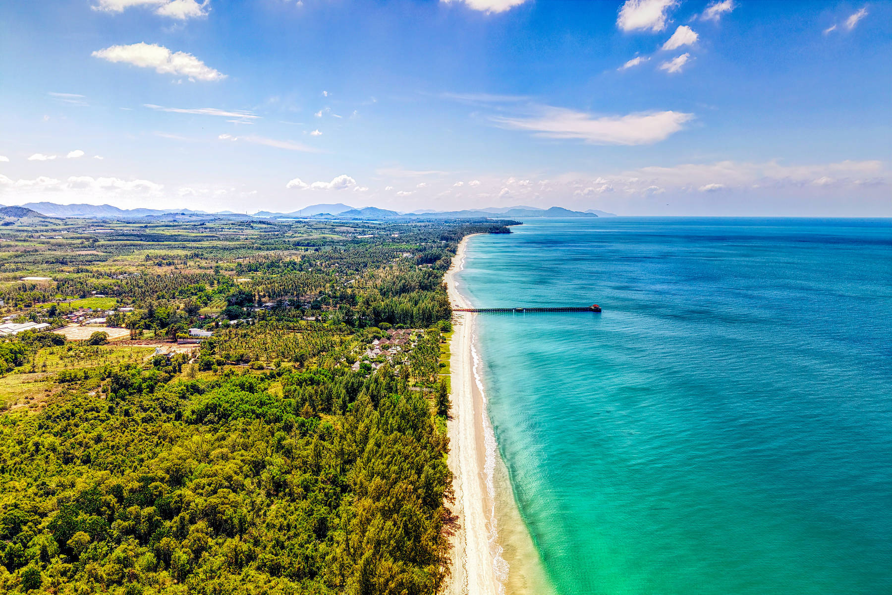
Cross the Sarasin Bridge off Phuket and within ten minutes the billboards stop. That is Natai — a beach most people fly over on their way somewhere louder.
Natai sits in Takua Thung district, Phang Nga province, on the mainland directly north of Phuket. Route 3006 runs the length of it, through coconut groves and lily lagoons, with public paths down to the sand. The southern stretch is also known locally as Pilai, after the village it falls within — one beach, two names.
There are no vendors. No umbrellas for hire, no jet-skis, no speedboats, no tailor shops. There is one independent beachfront restaurant, a public pier where locals fish at sunset, and a handful of private villas set back behind casuarina trees. On most days you will walk a long way before meeting anyone.
- Of coastline
- ~10 km
- From Phuket airport
- 25 km
- Zoned rural or agricultural
- ~70%
- Years building on this beach
- 20+
The reason it looks like this
Natai is not undeveloped.
It is zoned.
This is the part most visitors never learn. Natai is not simply a beach that development hasn't reached yet — the kind you buy into hoping to sell before it turns.
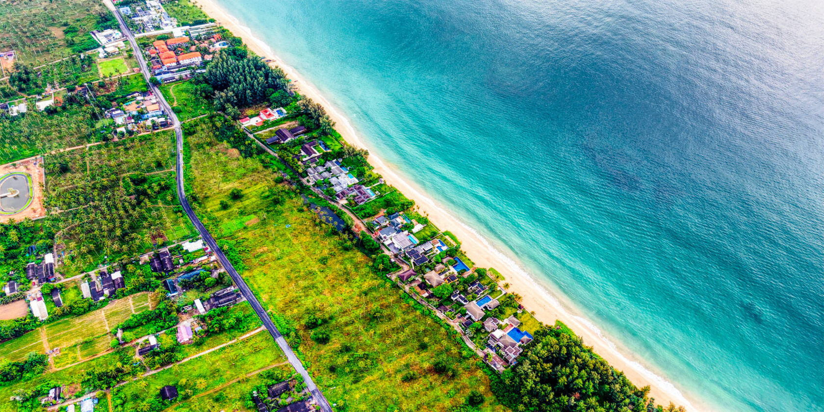
In July 2010, ministerial regulation under the Town and City Planning Act zoned this coastline — Khok Kloi, Natai, and north toward Thai Muang — into ten categories. Most beachfront land was designated forest conservation or agricultural use, restricting new development to single housing units. Around seventy per cent of Phang Nga province carries a rural or agricultural designation. The intent was stated openly at the time: Phang Nga did not want to become Phuket.
I
Conservation & agricultural zoning
Most beachfront designated forest conservation or agricultural — new development restricted largely to single housing units rather than resorts.
II
Construction control
Building restrictions in Takua Thung vary by distance from the coastline, measured from natural highest sea level. Basements are not permitted.
III
Finite frontage
Roughly ten kilometres of coast, already held by a small number of owners. Beachfront plots come to market rarely.
IV
Proximity, unchanged
The road from the airport will not get longer. Access without density is the entire proposition.
The zoning has favoured low density here for fifteen years, and we have built through all of it. But zoning is regulation, not geology — regulation is renewed on a cycle, and enforcement is never uniform. What doesn't change is the coastline. Ten kilometres is ten kilometres, whatever the town plan says.
Zoning and construction rules are summarised here as background, not as advice. Current terms should be confirmed by a Thai property lawyer for any specific plot.
Comparison
Natai, Phuket, Khao Lak
The three get discussed together and are not remotely alike. The honest version, including what Natai costs you.
| Natai | Phuket (west) | Khao Lak | |
|---|---|---|---|
| From the airport | 25 km | 15–40 km | 65–80 km |
| Density | Very low, zoned | High, mature | Moderate, growing |
| Beach character | Empty, no vendors | Busy, commercial | Mixed |
| Land supply | Finite, ~10 km | Effectively built out | Available |
| Typical buyer | Private, long hold | Investor, yield | Value-seeking |
| What it costs you | Quiet. Few amenities. | Everything, no peace | Distance from the airport |
Getting here
Thirty-five minutes,
one bridge
From Phuket International Airport, head north over the Sarasin Bridge onto the mainland, then Route 402 and 3006. No ferry, no transfer, no internal flight. Around thirty-five minutes in ordinary traffic.
That number is the whole argument. Natai is not remote — it is on the other side of a bridge most visitors never cross.
Questions
What people ask about Natai
Where exactly is Natai Beach?
Takua Thung district, Phang Nga province, on Thailand's Andaman coast — directly north of Phuket across the Sarasin Bridge. Roughly 25 kilometres from Phuket International Airport.
Is Natai Beach the same as Pilai Beach?
Largely, yes. The southern stretch falls within Pilai village and is often called Pilai locally. Same coastline, two names — which is why you will see both used.
Why is Natai so undeveloped?
Zoning, mostly. Since 2010, ministerial regulation has designated most of this beachfront as forest conservation or agricultural land, which restricts new development on those parcels largely to single housing units. That's kept density far lower here than in Phuket. It hasn't stopped every resort — a small number of hotels operate on or near the beach, generally on land zoned or permitted differently, or granted before the 2010 regulation — but it has kept Natai from becoming a resort strip. Zoning is regulation, not geology: it's renewed on a cycle and enforced unevenly, which is exactly why any specific plot's status needs checking with a Thai property lawyer, not assumed from the general picture.
Can foreigners buy property on Natai Beach?
Yes, through the structures available across Thailand — freehold via a Thai company, or long leasehold. Which suits depends on the buyer, the plot, and the intended use. It is a conversation, not a form.
Is there anything to do at Natai?
Very little, deliberately. A beachfront restaurant, a fishing pier, ten kilometres of sand. Phuket's restaurants, marinas and golf are thirty-five minutes away when wanted, and thirty-five minutes away when not.
When is the best time to visit?
November to April is the dry season and the calmest sea. May to October brings monsoon swell — dramatic, greener, and far emptier still. Owners tend to prefer the shoulder months either side.
The Collection
We have built on this beach
since 2005.
Thirteen properties currently available on this coast — some ours, all known to us.